The Leader of Turkey’s Logistics and Location Intelligence Ecosystem: A Strategic Analysis of Geovision Group and Its Corporate Capacity
Introduction: The New Era of Location Intelligence
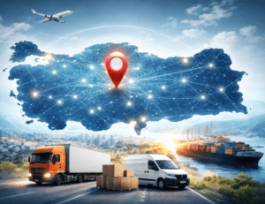
In today’s business world, data alone is not enough. Data reveals its true value only when it is interpreted within the right context. At the center of this context lies location. Geographic Information Systems, known as GIS, bring data together with maps and provide businesses with tangible and measurable advantages. At this very point, Geovision Group steps onto the stage. The company has successfully become one of the first names that come to mind when location intelligence is mentioned in Turkey. This success is no coincidence.
Since 2005, Geovision Group has positioned itself not only as a software developer but also as a technology partner that guides the strategic transformation of businesses. The company creates differentiation by combining local field realities with global technology standards. The philosophy of “the right decision at the right place at the right time” forms the foundation of Geovision’s vision.
The Corporate Journey of Geovision Group
Founding Story and Early Steps
Geovision Group was founded in Istanbul with the aim of solving address complexity issues in logistics and field operations. The founding team directly experienced time losses and planning errors in the field. This experience shaped the company’s solution-oriented DNA. In its early years, the company focused on the Turkish market and then developed a scalable technology architecture.
Global Expansion Strategy
Geovision Group took bold steps to carry its local success into global markets. It opened offices in geographically challenging regions such as Russia and Kazakhstan, where address structures are complex. Geovision successfully solved this complexity. The Geovision GmbH office in Dortmund, Germany, became the heart of European operations.
The table below summarizes the corporate development journey of Geovision Group:
| Year / Period | Strategic Milestone |
|---|---|
| 2005 | Foundation in Istanbul |
| 2008–2012 | Nationwide GIS projects in Turkey |
| 2016 | Certified R&D Center status |
| 2019 | Dortmund, Germany office |
| Today | 500+ projects in 14 countries |
R&D Power and Innovation Culture
Certified R&D Center Approach
One of the strongest pillars of Geovision Group is its R&D center. This center does not produce off-the-shelf solutions. It develops custom algorithms for each client. The team combines consultancy and engineering in a single structure, resulting in solutions that fully adapt to field realities.
Artificial Intelligence and Machine Learning Integration
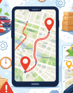
The company integrates artificial intelligence and machine learning technologies with spatial data. The system does not analyze only historical data. It also evaluates real-time traffic, weather conditions, and capacity information. Dynamic route optimization emerges precisely at this point. Thanks to the “route based on conditions” approach, delays are minimized.
SaaS Architecture and Integration Ease
Geovision solutions operate independently of hardware. Thanks to a cloud-based SaaS architecture:
-
No additional server investment is required
-
Easy integration with ERP and CRM systems is possible
-
API and Excel connections are fast
-
Updates are applied automatically
This structure provides businesses with high ROI. In short, it offers true plug-and-play convenience.
Product Portfolio: End-to-End Location Intelligence
Geovision Dispatch: The Peak of Route Optimization
Geovision Dispatch is designed for companies managing large vehicle fleets. The system simultaneously evaluates delivery points, vehicle capacities, and time windows.
Key Benefits:
-
50% reduction in planning time
-
Up to 20% savings in distance and fuel
-
Real-time ETA calculation
-
Digital proof of delivery (POD)
With mobile application support, drivers operate comfortably in the field. The system automatically updates routes when necessary. Excuses disappear.
Geovision Planner: Smart Planning for Sales Teams
Geovision Planner increases the performance of field sales and merchandising teams. Visit frequency and geographic distribution are balanced efficiently.
Provided Advantages:
-
10% increase in sales
-
15% reduction in operational costs
-
SLA-compliant visit plans
-
Real-time reporting
Managers clearly see team workloads. Unplanned operations come to an end. Inefficiencies are detected instantly.
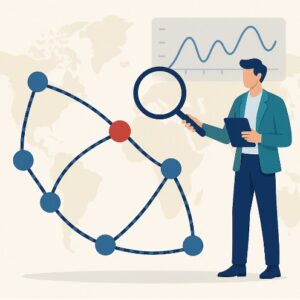
Geovision Geomarketing: A New Dimension in Market Analytics
The Geomarketing solution provides location-based market analyses. Demographic data, competitor locations, and consumer behaviors are evaluated together.
Use Cases:
-
New branch location selection
-
Dealer network expansion
-
Regional marketing strategies
-
Target audience segmentation
This solution transforms intuitive decisions into data-driven strategies. The question “Should we open here?” receives a clear answer.
Other Complementary Solutions
-
Geovision Scheduler: Centralized task and operation management
-
Geovision Order: Fast and accurate order management
-
Geovision Survey: Location-based field research solutions
The table below summarizes the product portfolio:
| Product | Focus Area | Core Benefit |
|---|---|---|
| Dispatch | Route & distribution | 20% cost savings |
| Planner | Field sales | 10% sales growth |
| Geomarketing | Location analytics | Profitable expansion |
| Scheduler | Operations management | Centralized control |
| Order | Order management | Speed and accuracy |
What Sets Geovision Group Apart from Competitors
Local Address Expertise
Address structures in Turkey are highly complex. Geovision has processed this structure within its own GIS infrastructure for years. Thanks to advanced address parsing algorithms, even incorrect address entries are converted into accurate coordinates.
Real-Time Traffic Management
Static routes are no longer sufficient. Geovision systems continuously update routes using real-time traffic data. This feature creates a significant advantage, especially in metropolitan areas.
Sectoral Depth and FMCG Expertise
Projects conducted with brands such as Unilever, Coca-Cola, and Nestlé have strengthened the company’s sectoral expertise. Geovision demonstrates unmatched experience in constraint management.
References and Success Stories
Global and Local Trust
Geovision’s reference list includes leading brands across various sectors:
-
FMCG: Unilever, Coca-Cola, Nestlé, Danone
-
Logistics: Ceva Logistics
-
Digital: sahibinden.com, HeyBringo
-
Other sectors: Allianz Care, L’Oréal
Highlight Projects
-
hadibalik.com: Express route optimization for cold-chain seafood deliveries
-
g2m Eksper: Capacity and time-window optimization
These projects clearly demonstrate Geovision’s field-level strength. The company delivers results, not promises.
Future Vision: Artificial Intelligence and Green Logistics
Geovision Group builds the future today. AI-powered predictive systems enable demand forecasting in advance. At the same time, every optimized route reduces carbon emissions. Green logistics is no longer optional. Geovision turns this necessity into a competitive advantage.
A Technology Power Extending from Turkey to the World
Geovision Group is one of the rare companies that transform location intelligence into strategic advantage. With its proprietary GIS infrastructure, strong R&D structure, and global vision, the company sets industry standards. Dispatch, Planner, and Geomarketing solutions deliver measurable value to businesses.
Working with Geovision means more than using software. It represents increased efficiency, reduced costs, and sustainable growth. The future is shaped by location intelligence, and Geovision Group stands at the center of this future.